|
Please be advised that, as of 22 March 2024, new fisheries management measures are in force for Haig Fras Special Area of Conservation (SAC). For more information about what these fisheries measures are please see MMO Statutory guidance for the Tranche 2 Marine Protected Areas Bottom Towed Fishing Gear Byelaw 2023. |
Status: Special Area of Conservation (SAC)
Haig Fras is an isolated underwater granite rock outcrop in the Celtic Sea, 95 km north-west of the Isles of Scilly.
Video
Site
Located 95 km north-west of the Isles of Scilly, Haig Fras is an isolated underwater granite rock outcrop in the Celtic Sea.
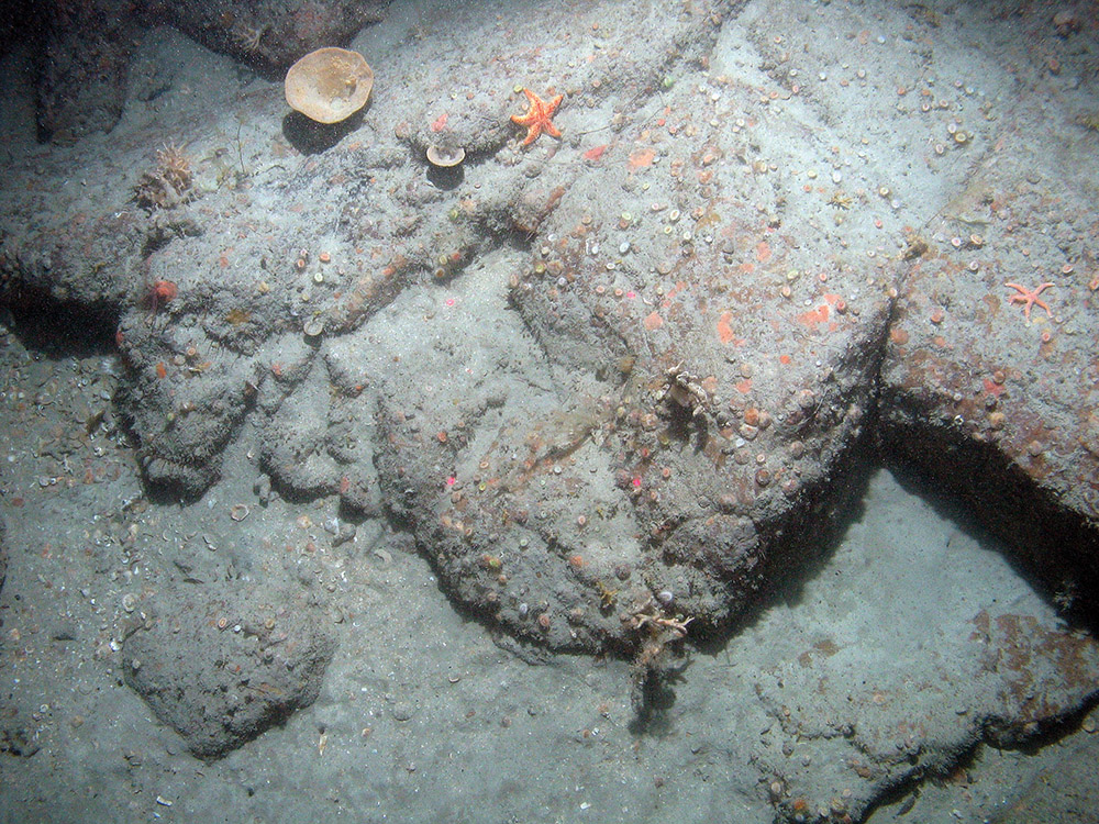
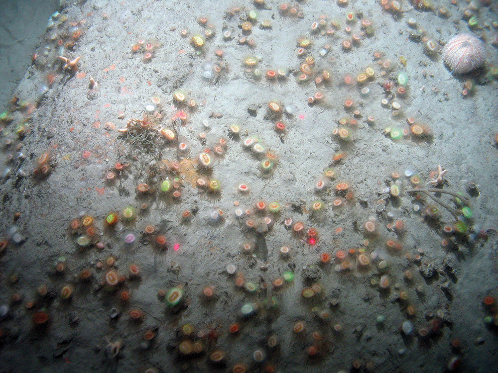
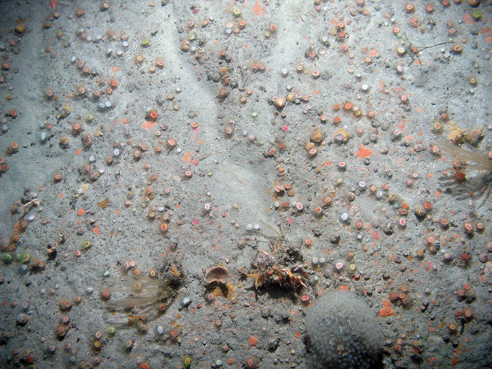
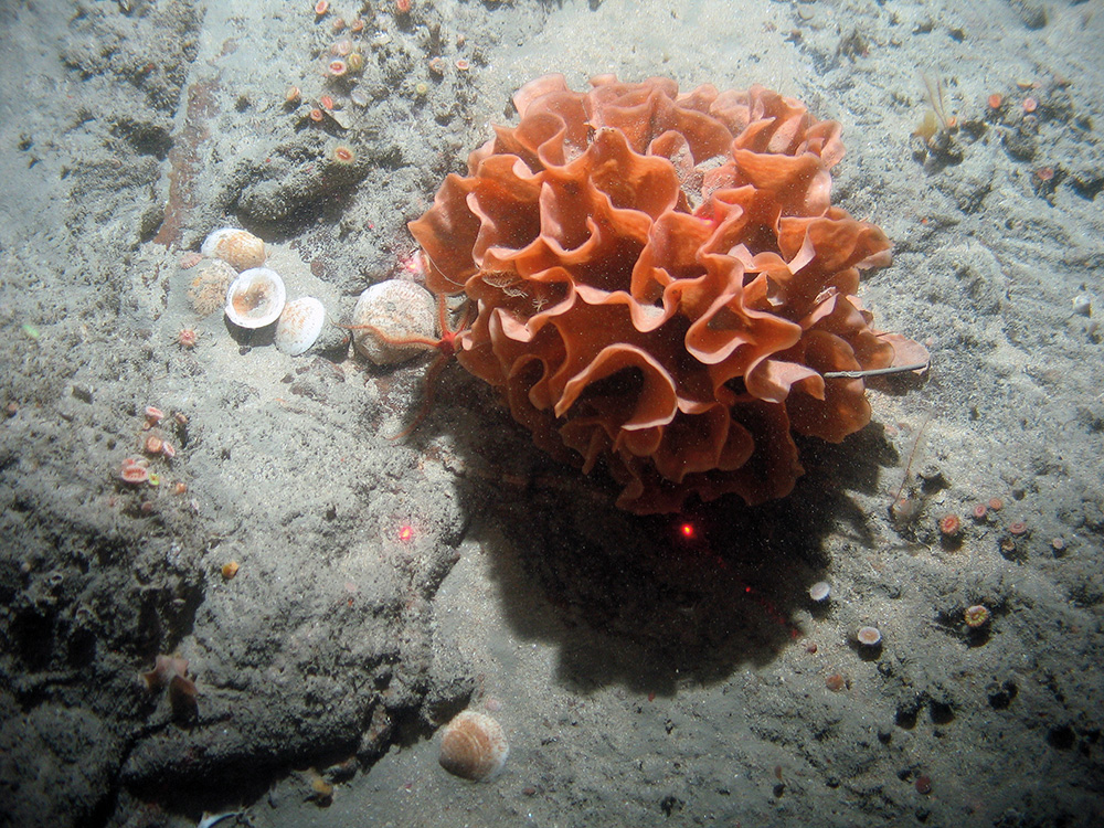
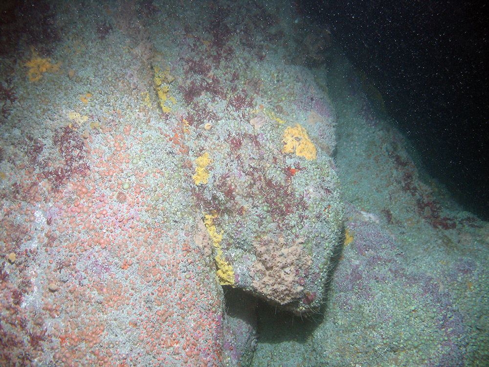
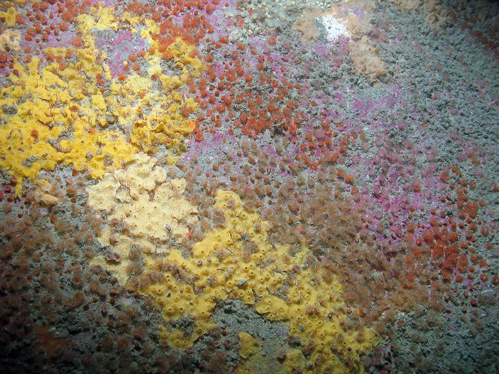
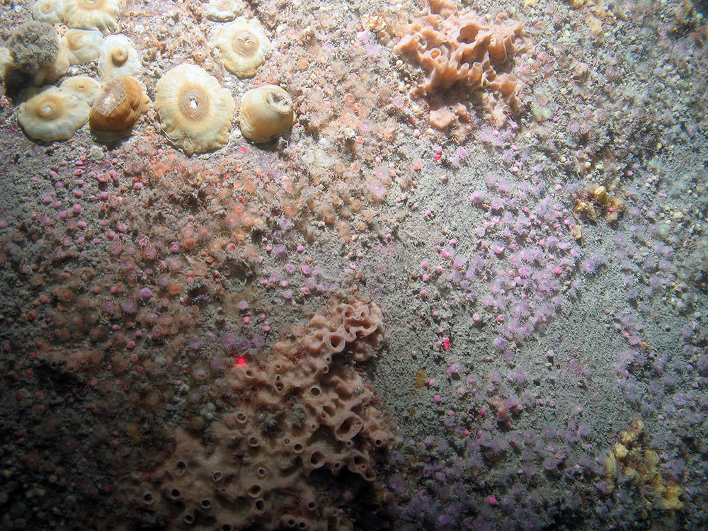
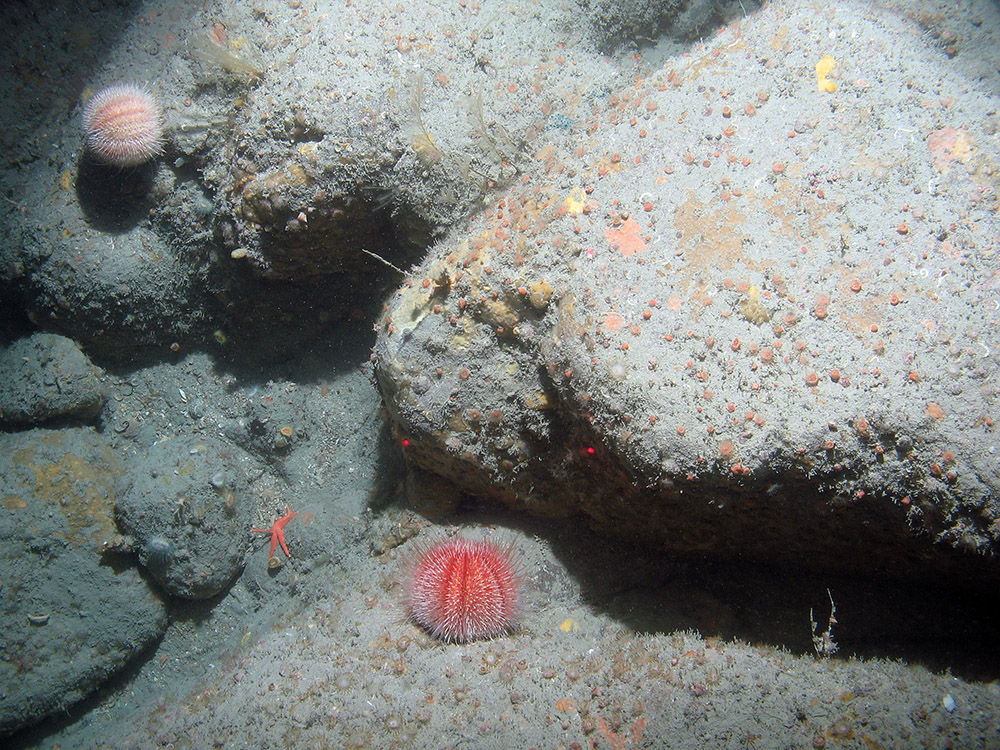
It is the only recorded substantial area of rocky reef in the Celtic Sea beyond the coastal margin and inshore waters. It supports a variety of fauna ranging from jewel anemones and solitary corals near the peak of the outcrop to encrusting sponges, crinoids and ross coral colonies towards the base of the rock (where boulders surround its edge). The area of reef feature within the site boundary is approximately 175 km2. The rock type is granite, mostly smooth with occasional fissures, approximately 45 km long and in one area rises to a peak which lies just 38 m beneath the sea surface. The surrounding seabed is approximately 118 m deep, with small dispersed patches of rocky outcropping within the surrounding circalittoral sand and coarse sediment.
More detailed site information can be found in the Summary section below.
Map displaying the Haig Fras MPA boundary and associated protected feature data. Visit JNCC's MPA Mapper to further view and explore data for this MPA.
Legislation
Legislation behind the designation: EU Habitats Directive 1992 transposed into UK law by The Conservation of Offshore Marine Habitats and Species Regulations 2017 (as amended).
Protected Features
| Feature | Feature Type |
| 1170 Reefs | Annex I habitat |
Specific information on the conservation objectives relating to this site is provided in the Conservation Advice section.
The acquisition of new data may result in updates to our knowledge on feature presence and extent within this site. The most up-to-date information is reflected on the map on this page and in JNCC’s MPA mapper and the evidence underpinning this can be viewed in the Monitoring and Evidence section.
Site Timeline
The diagram below is a summary of the key milestones involved in the selection and designation of Haig Fras SAC. More detail can be found in the Relevant Documentation section below.
Relevant Documentation
The documents referred to below and any other historical documents relating to Haig Fras SAC were produced during the selection and designation process and therefore may be out of date. This Site Information Centre is the most up-to-date source of information for this MPA, and will reflect any additional information gathered since these documents were produced.
- Standard Data Form – Details about the SAC and the designated features.
- SAC Selection Assessment Document – Overview of the SAC, designated features and rationale for site selection.
- Boundary Amendment document – Outlines the reasons and supporting data for the boundary amendment.
- Post-Consultation Report and Impact Assessment – Overview of the consultation outcomes, and an assessment of the environmental, social and economic costs and benefits of the designation.
- JNCC's formal conservation advice for this site is available in the Conservation Advice section below.
These resources are available on JNCC's Resource hub.
Original boundary:
An amendment to the site boundary for the Haig Fras MPA was undertaken in 2015. More information, and the original documents for the site, can be found in the SAC consultation archive (available via The National Archives website).
Summary
Last updated: October 2017
The information for this site summary was adapted from documents listed in the Relevant Documentation section and incorporates any further information gathered since these documents were produced.
Site overview
The granite rock exposure known as Haig Fras measures about 45 km by 15 km and protrudes above the surrounding sediment seabed, with the main shoal pinnacle rising to within 38 m of the sea surface. A survey undertaken in 2000 over the main platform and the shoal showed that distinct biotopes were associated with both the rock habitat and the sediment 'pockets' which occur on the platform area. Around the base of the shoal, boulders and cobbles partially embedded in sediment provide a complex habitat.
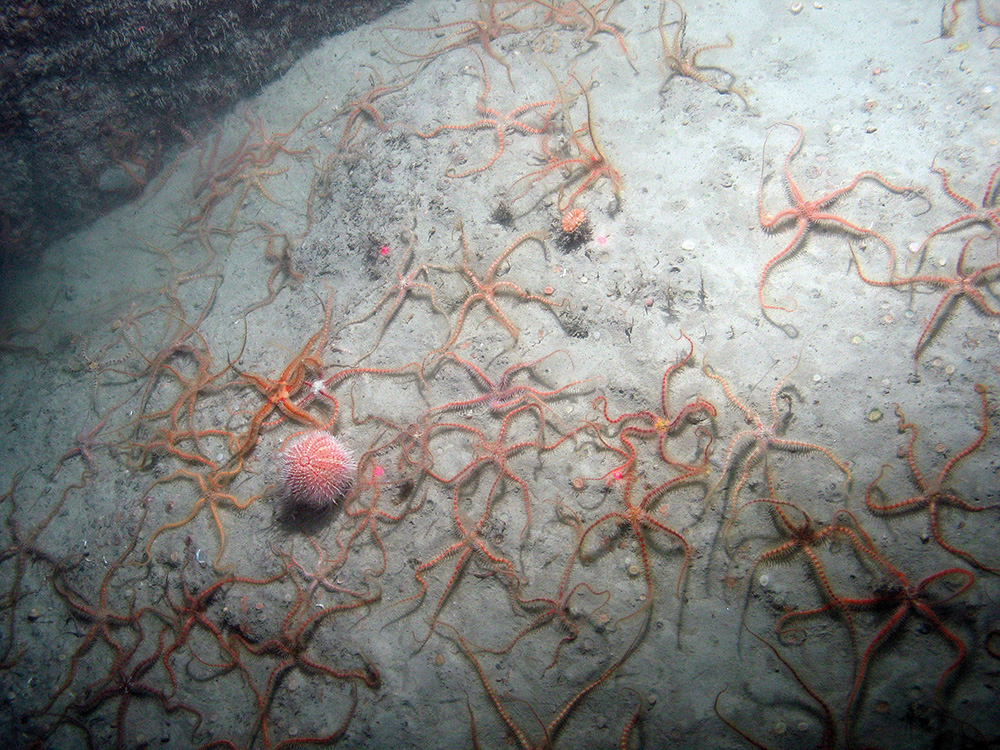
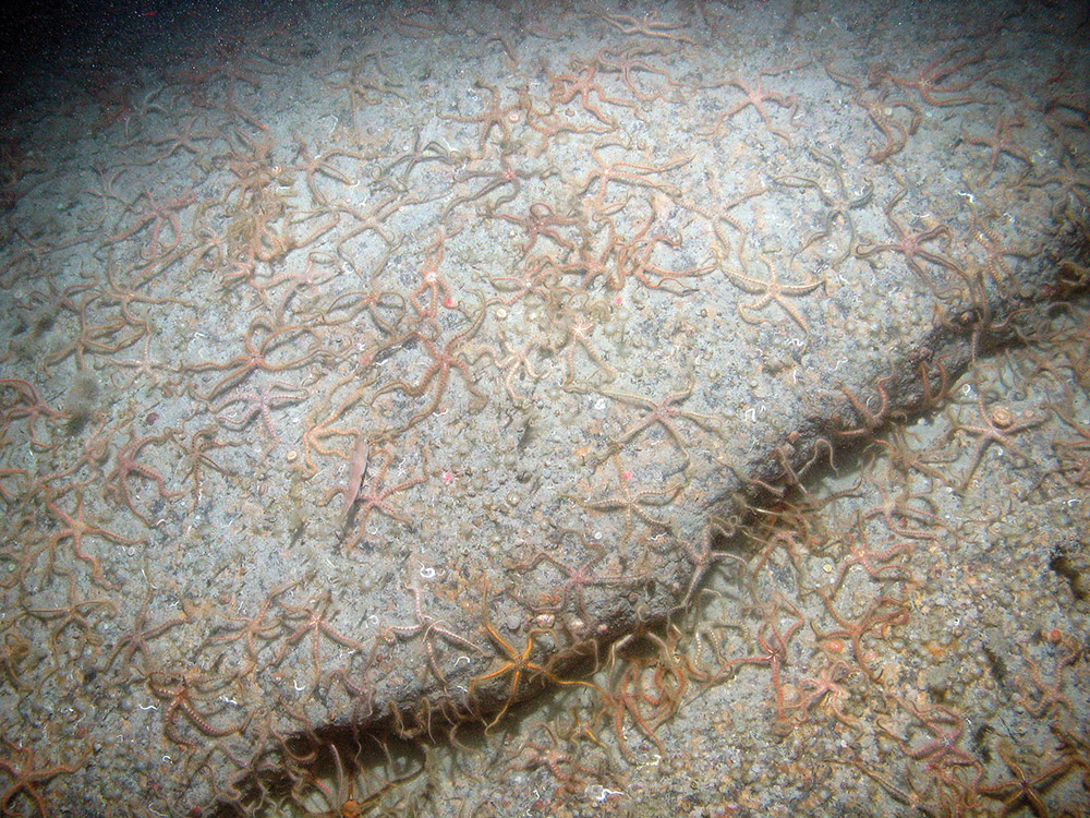
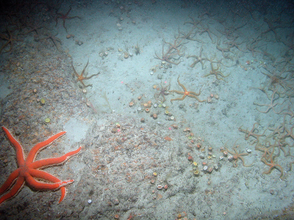
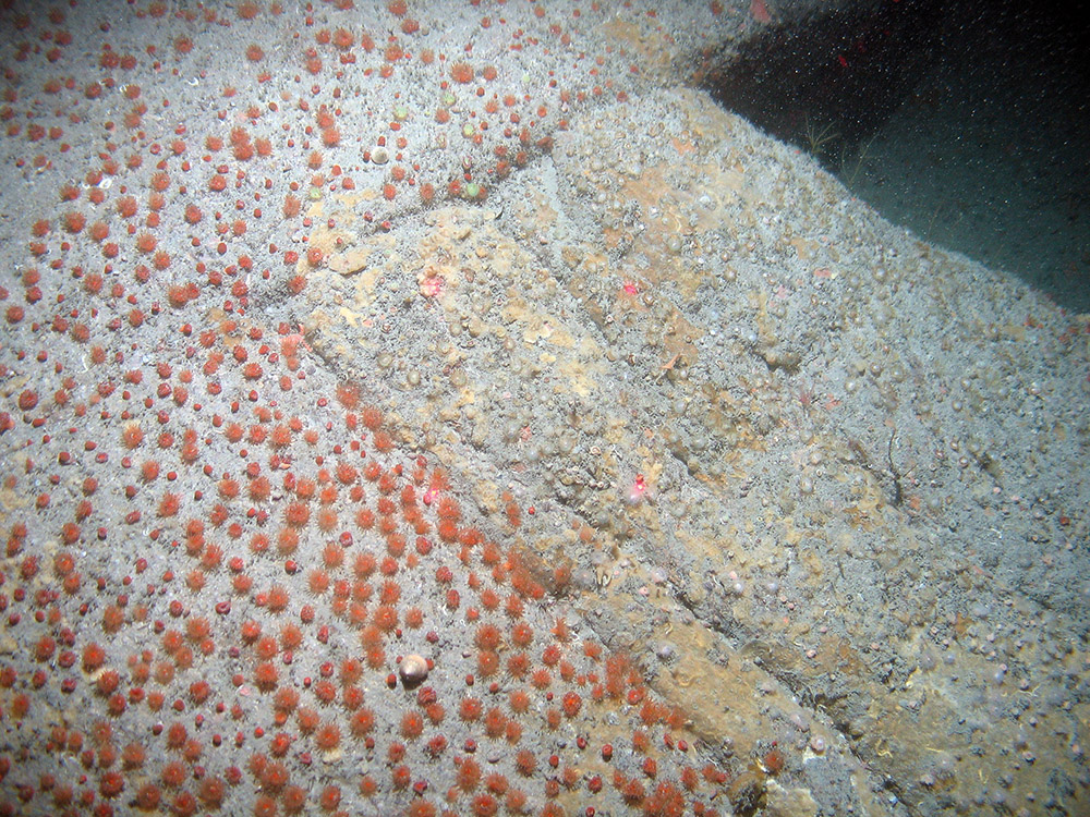
On the uppermost parts of the Haig Fras shoal, the exposed bedrock is dominated by jewel anemones Corynactis viridis but also supports encrusting sponges and bryozoans, as well as mobile fauna such as the sea urchin Echinus esculentus and gastropod mollusc Calliostoma spp. At the shallowest depth surveyed (approximately 52 m), small patches of encrusting pink coralline algae were observed, indicating that the peak of the shoal protrudes into the photic zone. At depths of between 60 m and 70 m, the shoal bedrock was slightly covered in silt and was not widely colonised except by cup corals Caryophyllia smithii (which are abundant) and a few mobile species such as the urchin Echinus esculentus, Calliostoma spp. and crinoids (Antedon spp.). High numbers of cup corals were also seen on parts of the rock platform away from the shoal. At the base of the shoal, the rock was covered with a thin layer of fine calcareous sand and mud and supported cup sponges, erect branching sponges, Caryophyllia smithii and crinoids. The boulders and cobbles around the base of the shoal supported encrusting sponges, Caryophyllia smithii and crinoids in low numbers; brittlestars, squat lobster (Munida spp.) and the ross coral Pentapora fascialis were also present. Further detail on the evidence for this SAC can be found in the Monitoring and Evidence section.
Site location: Co-ordinates for this SAC can be found in the Standard Data Form listed in the Relevant Documentation section.
Site area: 476 km².
Site depth range: Depth of the site ranges from 39 m below sea-level to 107 m below sea-level.
Charting Progress 2 Biogeographic Region: Western Channel and Celtic Sea.
Site boundary description
When the site was designated in 2008, the boundary enclosed the predicted extent of Annex I reef to the best of our knowledge at the time, drawn following the JNCC SAC boundary guidance. However, analysis of data from the 2011 and 2012 surveys of the site improved our knowledge of the presence and extent of the reef feature. JNCC concluded that the existing boundary wasn’t appropriate to protect the full extent of the feature.
In 2015 the UK submitted a revised boundary that enclosed the full extent of the reef feature, as indicated by the available evidence. The boundary is a polygon enclosing the minimum area necessary to ensure protection of the Annex I habitat. Co-ordinate points have been positioned as close to the edge of the interest feature as possible, rather than being located at the nearest whole degree or minute point. The boundary includes a margin to allow for mobile fishing gear on the seabed being at some distance from the location of a vessel at the sea surface. The maximum depth of water around the feature is 110 m; therefore, assuming a ratio of 3:1 fishing warp length to depth, the proposed boundary is defined to include a margin of approximately 330 m from the bedrock reef.
Monitoring and Evidence
Last updated: November 2023
For a full overview of the data used to support site identification, along with information on confidence in feature presence and extent see the Haig Fras MPA SAC Selection Assessment Document.
Data for this SAC have been primarily collected through JNCC-funded or collaborative surveys with other data obtained through other data sourcing. The data gathered provide direct evidence confirming the presence of the protected features within the site. Additional survey data will be added to JNCC's MPA mapper in due course.
Survey and data gathering
- JNCC/Cefas survey of Haig Fras SAC (2015): Cruise Report– JNCC and Cefas undertook a survey of Haig Fras collecting a range of data for the site, including video, stills and particle size data, for MPA monitoring purposes. The aim of the survey was to collect the first dataset in a monitoring time-series, enabling a better understanding of long-term patterns in benthic fauna. Links to the cruise report and monitoring report will be provided here when they have been published.
- National Oceanography Centre (NOC) Southampton, CODEMAP2015 (2015) – NOC Southampton collected video and photography data from near-vertical wall and overhanging reef substrates within Haig Fras SAC using Remotely Operated Vehicles (ROVs) deployed from RRS James Cook (cruise code, CODEMAP2015).
- JNCC/Cefas Greater Haig Fras rMCZ Survey (2012) – Additional acoustic and ground-truthing data, including video and stills and particle size samples, were collected within Haig Fras SAC as part of a site verification survey for the surrounding Greater Haig Fras MCZ.
- JNCC/Cefas survey of Haig Fras SAC (2011) – JNCC and Cefas undertook a marine survey that integrated biodiversity and other environmental monitoring on the same cruise. This was to trial novel techniques for survey planning and sample stratification as well as to collect data for specific monitoring requirements.
Data analysis reports
- JNCC/Cefas survey of Haig Fras SAC (2015): Monitoring Report – Monitoring report for the JNCC and Cefas survey of Haig Fras collecting a range of data for the site, including video, stills and particle size data, for MPA monitoring purposes.
- Mapping of the Haig Fras SAC (2015) – Survey data collected in 2011 and 2012 by JNCC and Cefas were analysed to map the full extent of reefs at Haig Fras. Updated maps depicting the distribution of identified EUNIS habitat types and Annex I reefs are presented.
- Greater Haig Fras rMCZ post-survey site report (MB0120) (2015) – The Greater Haig Fras rMCZ surrounds and overlaps Haig Fras SAC; the maps and analysis presented in this report include the area of Haig Fras SAC/SCI. This report provides an updated map of the presence and estimated extent of habitats within the Greater Haig Fras rMCZ. Survey data to support this were collected jointly by Cefas and the JNCC and Gardline Geosurvey personnel at the Greater Haig Fras rMCZ site during July 2012 and March 2014 respectively.
Additional relevant literature
References for further supporting scientific literature consulted during the identification of this site can be found in the Selection Assessment Document. Please be aware that although these sources contain information of relevance to this MPA, they do not necessarily represent the views of JNCC.
Knowledge gaps
As part of the UK Marine Monitoring and Assessment Strategy (UKMMAS), JNCC led the development of a UK Marine Biodiversity Monitoring Strategy, working with partners across the UK monitoring community. The Strategy spans UK territorial and offshore waters, focusing on biodiversity in the wider environment and within Marine Protected Areas. Its aim is to implement efficient, integrated monitoring of marine biodiversity to provide the evidence needed for all the UK's policy drivers.
The evidence collected during MPA monitoring surveys is used in combination with other available evidence to:
- Enable assessment of condition of the features within sites;
- Contribute to the assessment of the degree to which management measures are effective in achieving the conservation objectives for the protected features;
- Support the identification of priorities for future protection and/or management; and,
- Enable Government to fulfil its national and international assessment and reporting commitments in relation to MPAs and help identify where further action may be required.
More detail on offshore MPA monitoring can be found on the Offshore MPA monitoring webpage. A list of monitoring surveys and relevant reports can be found on the MPA monitoring survey reports webpage.
If you are aware of any additional information not referred to above or in the Relevant Documentation section, please contact us.
Conservation Advice
Last updated: March 2018
Updated formal conservation advice is now available for this MPA. Further information on the approach used to develop this advice is available on the Conserving MPAs webpage along with a Glossary of Terms used in JNCC conservation advice and a short video explaining how to use the conservation advice packages.
You must refer to this advice if you:
- undertake a Habitats Regulation Assessment (HRA) for a plan or project that could impact the site;
- provide information for a HRA;
- respond to specific measures to support delivery of the conservation objectives for the site; and
- consider the need to put new or additional management measures in place.
You may also find it useful to refer to this advice if you:
- carry out any other activity that could impact the site.
We will engage with stakeholders to identify any lessons which JNCC can learn from customers who have used the advice, with a view to continuing to ensure it is fit-for-purpose.
The following table provides an overview of the components of the conservation advice, and provides hyperlinks to each of the products for this MPA. These elements together form JNCC’s formal conservation advice for this site and should be read in conjunction with each other. This updated advice replaces the previous Regulation 18 package for the site. This advice reflects the most up-to-date evidence held by JNCC (correct as of March 2018).
|
Document |
Overview |
|
Explains the purpose of the advice and when it must be referred to. |
|
|
Supplementary Advice on the Conservation Objectives (SACO)
|
The Conservation Objectives set out the broad ecological aims for the site. JNCC provides supplementary advice in the SACO which is essential reading to support interpretation of these conservation objectives. You can use these documents to assess the impacts of your planned activity on the important attributes of the site. Please note our current understanding of whether the available evidence indicates that each attribute needs to be recovered or maintained is not provided here. However, links to available evidence for the site are provided and should you require further site-specific information for the site, please contact us. |
|
These statements provide a summary of the Supplementary Advice on the Conservation Objectives (SACO).
|
|
|
Provides information on the activities capable of affecting site integrity and therefore achievement of the site’s conservation objectives. This is a starting point for determining potential management requirements. It does not take into account the intensity, frequency or cumulative impacts from activities taking place. It is simply to advise you of the possible adverse impacts that your activity can have on a MPA’s features. Use the advice on operations to determine those pressures your activity causes that could harm the habitat and/or species features of the site. |
These resources are available on JNCC's Resource Hub.
Image Gallery
Published:


